 |
 |
 |
 |
 |
 |
|
|
|
Partners:
Frank Konsella, Dave Bourassa
Route Description: Summer route to summit (La Plata Gulch Trailhead up NW ridge), North Chutes descent Data: TH- 10,160; summit- 14,336; approx ski descent to 12,600 ft (1,700 vert). Began hiking at 5:45 am, summited at 9:00 (3hr 15min hike), estimated at bottom of snow around 10 am, back to car around 1:30 pm Relevant Links: TGR Trip Report 2nd trip- June 19, 2010 |
|
Report:
After skiing Elbert and getting that excellent view of La Plata, I just had to get it done. Those beautiful north chutes were calling my name.
Dave and I met in Golden the night before, and drove to the La Plata trailhead where we met up with Frank. We camped off of the dirt road that begins at the La Plata trailhead. The day began early, starting our hike at 5:45 am from the La Plata Gulch trailhead. I was barely awake and was disturbed that I did not bring my coffee :( Thankfully Frank saved the day as he brought enough coffee to share with all of us :) My morning went from foggy to sunny very quickly, and the sun had not even risen yet. That's a good thing ;) I think Dave was as foggy as me because he left his half-eaten breakfast muffin sitting on a rock by the trailhead (which we found at the end of the day). :) Frank hiking up the switchbacks toward the northwest ridge.
Thank Dave for this wonderfully creative photo.
And this one too.
Less than three hours later we were at the summit, where we got these great views. Ice mountain is looking good!
Frank scoping out the lines on the north chutes.
Mt. Elbert and Mt. Massive in the background, the two highest peaks in Colorado. Just a week earlier we'd been on Elbert! Ellingwood ridge is in the bottom of the photo, another route to the summit of La Plata. Now, remind me, why didn't we take that way again?
Me: "Yep, there's snow at that there summit and we're going to ski on it!" :)
Okay, let's ski it! Dave and Frank strap on their skis for the descent.
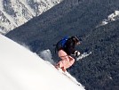
Frank dropping in:
Frank shows off:
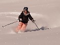
Dave goes for it.
Dave shows us just how steep it really is:
And he found some nice corn snow too!
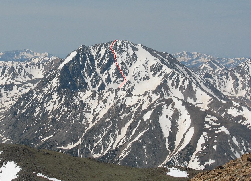
We skied to the bottom of the chutes and this was our view looking up. Our approximate route is marked.
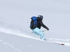
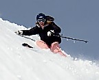
Thanks to Dave for taking pics of me! :)
We were able to ski a ways into the basin before the snow ended. Then we took off our skis, and traversed high around the northwest ridge to our left, making sure to stay above treeline. It's easier to stay above treeline than to bushwhack through the forest. We traversed all the way to the other side of the northwest ridge, and followed an avalanche gully down to the La Plata Gulch trail. The forest was hot, sticky, and full of mosquitos.... So, when we saw this....
I wanted to go into the river. Thoughts of tubing this thing down crossed my mind both on the way up, and even more so on the way back down. What do you all say? Lets go tubing! |
|
Route Pictures Click for a larger view. |
|
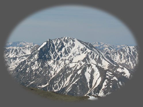
Our line seen from Mt. Evans.
|
Photos contributed by Dave Bourassa.


