 |
 |
 |
 |
 |
 |
|
|
|
|
Partner:
Jon Turner
Route Description: From Halfmoon Creek TH, ascended SW couloir and then followed along near the ridge to the top. From summit, E face for a bit than took saddle back over to SW couloir. Data: Began at Halfmoon Creek TH (10,530') at 5:35 am. Walked the trail to turn off to couloir. Followed trail for a bit up this way until it became to snowy. Then used crampons up the snow path. Took SW couloir to above the saddle. Followed path on the east side along ridge to summit. Reached summit around 10:30 am (14,421'). Skied just below ridge on east face to saddle at 13,900'. Then took off skis and traversed across talus to SW couloir. Snow in couloir began around 14,000 ft. Descended couloir on skis to about 12,200 ft. Walked the rest of the way. Back to car at 1:30 pm. Total vert climbed: 3,890'. Total vert skied: 2,200'. Total time: a bit under 8 hours. Relevant Links: TGR Trip Report |
|
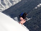
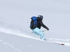
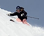
Report: Mt. Massive has been on my list for awhile. I'd wanted to do it about this time last year, but never got around to it. I'd talked about doing in in March and April, but snows prevented me from doing so. Jon Turner and I had spoken about doing Massive several times, but timing/weather never worked out for us. Yesterday it finally worked out for us! We met at the gas station near the corner of the turn off for Half Moon Creek Road and then drove up to the North Halfmoon Creek TH. Jon's Jetta would only make it a bit past the South Halfmoon Creek TH, but my Subaru made it all the way to N Halfmoon, but I did have to be careful on a few sections. Our plan was to approach Mt. Massive from the SW couloir. The trail along Halfmoon Creek is easy and we made good time on it. Where the trail breaks off toward the SW couloir, the turn off is marked with a large cairn that is pretty much impossible to miss. The trail is steep, but is relatively easy. There was a snow field that went down as far as 12,200 feet on the south side. But we chose to stay on the snow-less trail as far as we could. We were able to follow the trail up to about 13,000 feet or so before we were crossing enough snow paths to warrant going a snow route. We left the trail, and took a very obvious snow route the rest of the way up. On our way up the winds began to increase more and more. We eventually saw storm clouds moving in. A cold front was on the way. Time to hurry up! The SW couloir takes you to a ridge that is south of the summit of Mt. Massive. The winds were increasing more and more as we approached the ridge and became a factor in choosing our route. Sometimes gusts would be so strong that they would knock me to the ground- largely due to the "sails" of my skis on my pack. When we ended up on the ridge and looked north, the ridge looked daunting, especially with the wind. But we headed over to the east side of the ridge. There, the wind was significantly less, and there was an obvious route there, which wasn't apparent from the other side of the ridge. This route required us to sometimes stay below the actual ridgeline, but on the east side of it, crossing many snowpaths along the way. Other times it required us to climb up onto the actual ridgeline rocks. If you go this route, don't be deceived. There's quite a few false summits along the way! As we approached the actual summit the weather was worsening, quickly. There was snow falling and visibility was quite limited. When we got to the summit the storm had moved in full-fledged. It was dreadfully cold and windy (well, for June anyway!) and we couldn't see more than 20 feet in front of us. Our plan all along was to ski a bit down the east face, work our way to the saddle south of Massive, and then traverse over (w/o skis) back to the SW couloir. This was still our plan, but we were worried about being able to find the saddle since we couldn't see it. Because of that our ski descent on the east face was a bit less than desirable. We did a lot of traversing, trying to stay high near the ridge so we could find the saddle. We began our traverse, trying to keep the ridge above us in sight the whole time hoping we wouldn't go down too far and miss the saddle. Thankfully, we found the saddle without any issues. At the saddle we took off our skis and put them back on our packs to traverse over talus back into the SW couloir. The traverse over was pretty bad. The wind was blasting. The talus was really loose. And the rocks were really slippery due to newly fallen snow. We took our time traversing. We were both knocked to our feet by the wind several times. Thankfully, we found our SW couloir without any problems and began skiing. After we'd descended about 1000 feet from the summit the visibility began to improve and we were finally able to take a few ski pics! At about 12,200 ft the snow field ended. So, we found the trail and we packed our skis back on our packs. We enjoyed the freshly fallen snow all the way back to the car. All in all it was a good day. The oncoming cold front and near white-out conditions made for a more interesting day for sure! Thanks Jon for taking a day off to go ski with me! |
Topo Map
Click for a larger view.

Route Pictures Click for a larger view.
|
Looking back up at our ski route
|
Looking down at our ski route
|
Photos courtesy of Jon Turner.
The slideshow above is a free DHTML scripts provided by
Dynamic Drive